10.5 miles | 1,847 ft gain | Difficulty: Moderate | Rating ★★★★★

Not a high peak, but what I would consider one of the premiere hikes in the high peaks region. Many hike Indian Head as a quick stop on their way up (or down) Blake and Colvin or Dial and Nippletop. We orphaned Blake and have to do that pair again, but we always find ourselves too exhausted for just another half mile or couple hundred feet up. With the Adirondack Mountain Reserve’s (AMR) newly created parking reservation system, this felt like a low stakes way to test the system.
I know many are are irritated with the AMR system and worry what it might mean for other parking areas. I too have my concerns – it allows 70 reservations to align with the 70 parking spots, but people being dropped off or taking the bus pool from that same lot, meaning you could end up with all reservations taken but an empty parking lot. Second, the reservation times don’t matter but allow only one per spot per day. Typically you may have a group coming in super early and leaving mid morning when someone else is arriving. Someone might show up just before dark for a sunrise hike. While I appreciate the convenience of not having to fight for a spot at 5am, there are many improvements to be made.
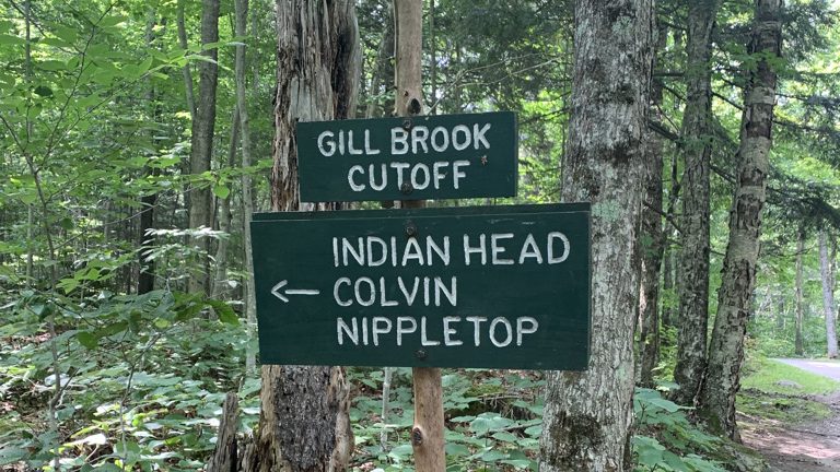
We showed up at the leisurely hour of 10:30am to start our hike. It was kind of incredible not having to wake at the crack of dawn. The trail to Indian Head is about 4.5 miles, but as with most trails from the AMR, it involves significant miles on Lake Road, a wide gravel road. Nearly 3 miles in (still with at least 500 feet of elevation gain), we turned off the road to a steady bipass trail, where we shortly intersected the Gill Brook Trail that we know well. There we stayed for .1 mile before heading right and up again climbing steadily then steeply.
We summited Indian Head during our hike, but as to the exact point of the summit, I couldn’t tell you. The real views are to the north and south. Once we got to a levelish part, we darted right and down a bit to the north outlook. The outstanding views were dominated by Giant largely in the distance. To our right, Dial and Nippletop. There’s something very satisfying about taking in a mountain view and knowing you’ve climbed all of them.

Back in the woods and a short climb further, we reached the classic southern views – a cliff overlooking Lower Ausable lake. It’s like a parting of the mountains – the Colvin Range to our left and Great Range to our right. Down below we saw canoes and kayakers enjoying the pristine water.

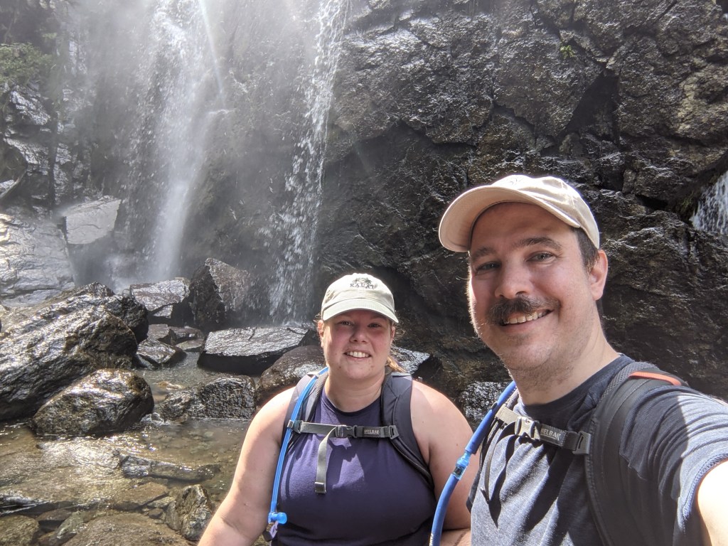
Feeling invigorated by our hike and always looking for an excuse not to do an out-and-back, we overheard the group next to us talking about how stunning Rainbow Falls was. When we were there last, in fall 2019, it was only a trickle. However, with the strong spring snowmelt, combined with the influx of rain over the last few weeks, it was apparently fuller than it has been in years.
We took the steep Indian Head trail down, across the Lower Ausable Dam and up slightly to the falls. If I had been a bit braver, I could have gotten right underneath.