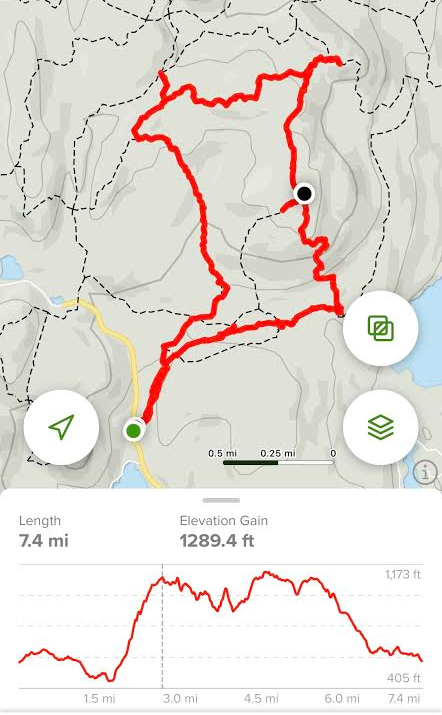
7.4 miles | 1,289 ft gain | Difficulty: Moderate | Rating ★★★★★
We took the long path. Intentionally? Unintentionally? I’m not entirely sure. It’s not unusual for our recorded hike to be slightly longer than AllTrails, but a 20%+ difference is a bit much.
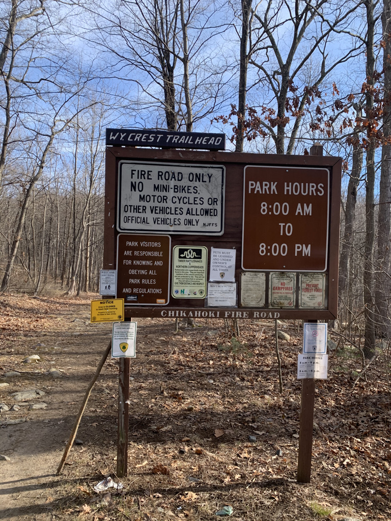
My husband and I have naturally fallen into our hiking roles. I lead and set the pace, he navigates, announcing turns, trail changes and when/if we’ve veered off track. It usually works out, with occasional missteps, so when he announced that we weren’t on trail, but running parallel and would still meet our intended path shortly, I wasn’t concerned. Had we prepared better, we would have read the New York-New Jersey Trail Conference description, warning us to make an immediate left on the yellow blazed Wyanokie Crest Trail instead of walking the wide fire road. But we were about a mile in and I didn’t really feel like back tracking all that way.
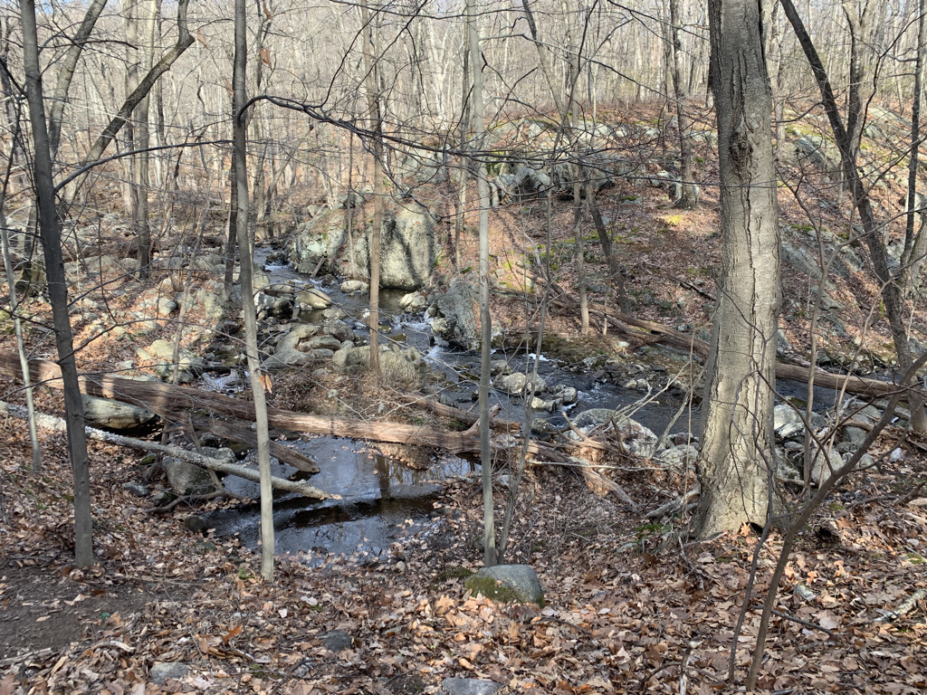
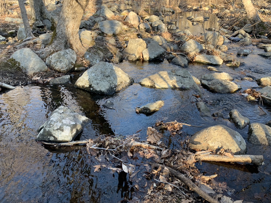
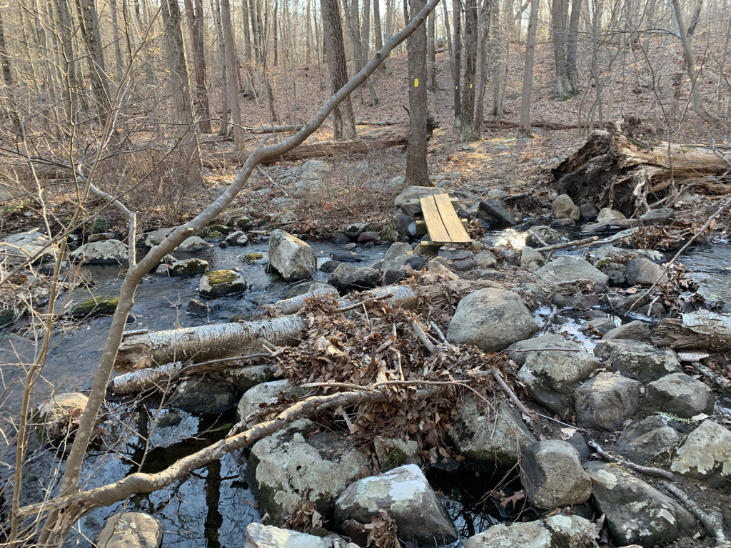
We somehow missed the brook. We were on one side of Post Brook, while our trail and destination on the other. Normally, I’m all for a stream crossing. Rock hop, wade through, whatever it takes. But it’s January. And the 1-2 foot deep body of water was frigid. And any obvious path of rocks was specked with visible ice. I felt like a dog, pacing back and forth on the shoreline trying to figure the safest way to cross. Falling into the water wouldn’t necessarily mean injury but it would guarantee the end of our hike.
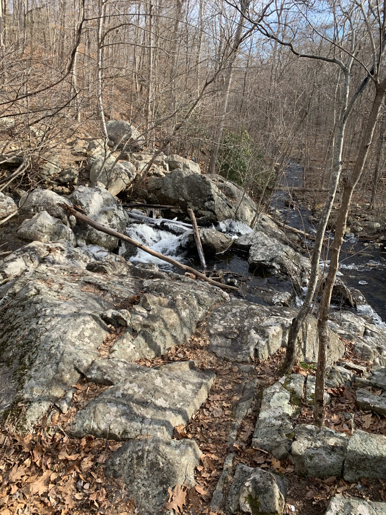
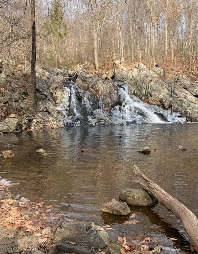
The positive side of our missteps was Chikahoki Falls. Had we followed the correct path, we would have ended up at the top of the falls with a few nice views looking down. However being on the other side, we met it from the side, and after a short, steep climb down, were able to enjoy it in its full glory head on.
Our first mile and a half took nearly an hour with the weaving back and forth and path to safe stream crossing. Once on the right trail, the hike offered everything one could hope for – varied forrest trails, rock scrambles, increased heart rate, and stunning views of the Wanaque Reservoir at multiple points along the trail.
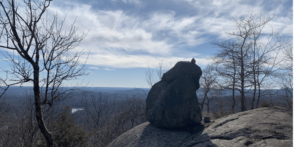
From Chikahoki Falls, we traveled up, up, up to Carris Hill for some of our first views. We then followed the blue Hewitt Butler Trail, hugged the cliffside for a bit getting better and better views of the reservoir until we reached Yoo-Hoo point. From there we could see our next destination, Wyanokie High Point, across the woods.


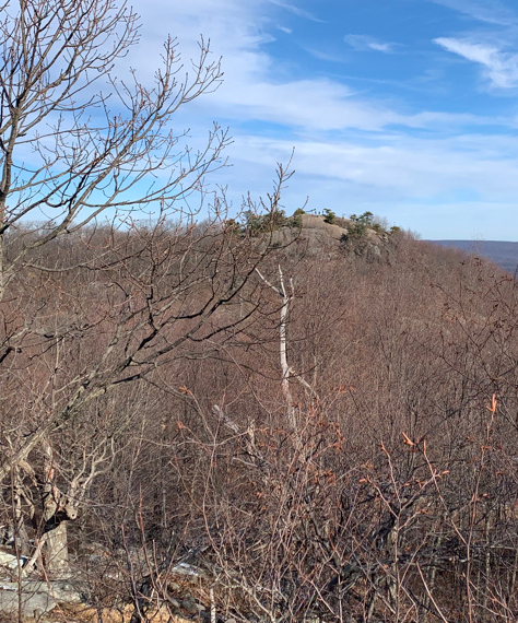
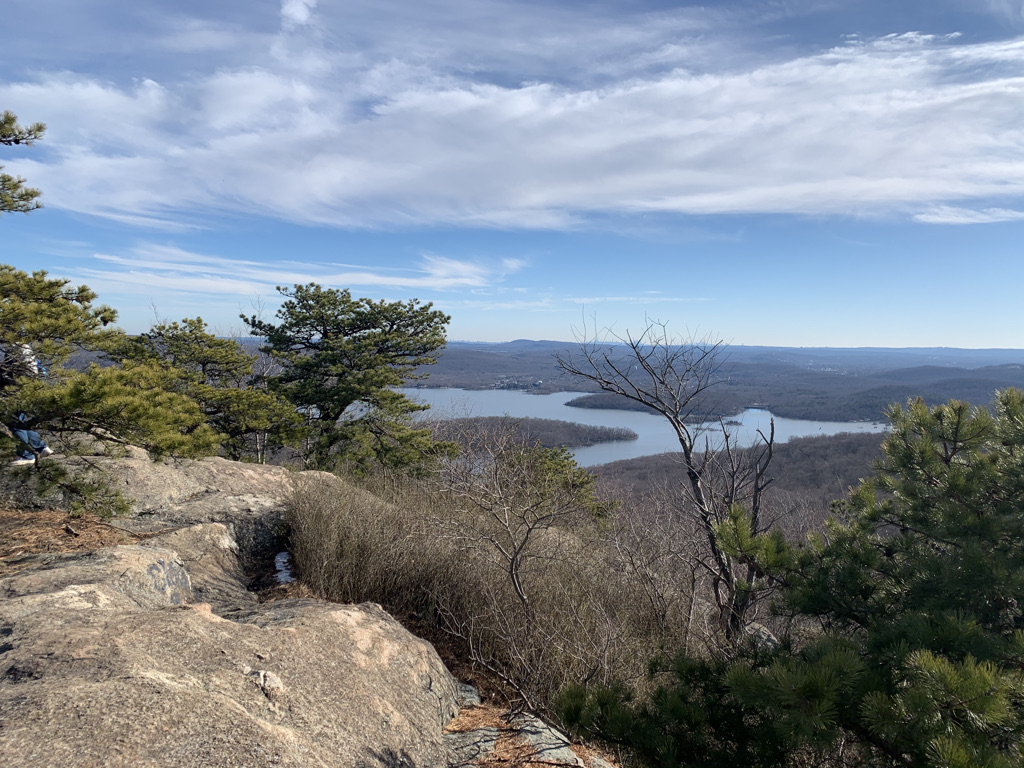
Headed back into the woods, then a short scramble up Wyanokie High Point, we found a number of small groups and pairs enjoying the view and sun on the chilly January day. (it was only after we finished our hike driving home that we saw the other overcrowded parking areas; we were fortunate to start from a smaller lot along the road, that was just filling when we arrived at 11am). Ironically, Wyanokie High Point was not our highest point of the day. We headed back into the woods, joining the red Wyanokie Circular trail, where we hit our viewless, highest point at 1,124 feet, then continued on, nearly missing our switch to the orange Outlaw Trail.
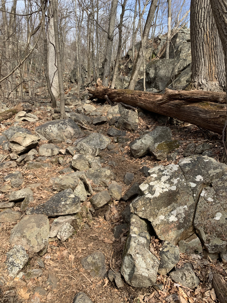
The final 2 miles when we eventually rejoined the yellow Wyanokie Crest Trail were beautiful and wild. It was less of a trail, going over boulders and water crossings, and more a free form open wood, moving blaze to blaze. I could see how the trail could be overly muddy in the spring or slick with fresh fallen snow, but the openness and solitude was just right the day we traveled it.
For less than an hour’s drive from Brooklyn, the hike checked all the right boxes. And though we saw many people on the trail, the multitude of intersecting trails in Norvin Green State Park meant we never felt too crowded or traveled the same exact route of other for too long.